CHARLESTON, W.Va. — The wait for Florence continues in West Virginia.
“The storm is trending further south, but what happens when it eventually does make landfall is the storm stalls out and, pretty much, where it tracks after that is up in the air at this time,” said Meteorologist Mike Kistner with the National Weather Service on Wednesday morning.
“The track of the system will determine how much rainfall that West Virginia actually sees.”
As of Wednesday morning, Florence was expected to slow down more by Thursday into Friday before projected official landfall early Saturday in either southern North Carolina or northern South Carolina.
“Those areas are pretty much going to be the Ground Zero of the storm,” said Kistner. “The remnants that could possibly come up here (to West Virginia) are basically going to contain the heavy rain.”
Even before Florence makes landfall, its moisture will flow ashore toward Appalachia – meaning we'll have showers and storms through the week regardless of track. Here's the risk for excessive rainfall through Friday. Stay tuned for more #Florence updates. pic.twitter.com/gZ05kgyGlg
— NWS Charleston, WV (@NWSCharlestonWV) September 12, 2018
En route to North Carolina on Wednesday was a team with the U.S. Coast Guard Marine Safety Unit out of Cabell County.
Six team members traveling with a trailer and three boats were bound for Seymour Air Force Base located near Raleigh, North Carolina to ride out Hurricane Florence. After landfall, the team would be answering rescue calls alongside local officials as unit have done in past disasters.
“They get tied into the local Emergency Operations Center so that we make sure that we have good connections with the state and the local and municipal officials,” explained Commanding Officer Paul Mangini.
“They can direct and support the needs of the local emergency officials.”
At the same time, Mangini said work was underway to prepare for potential flooding in West Virginia.
“We are taking the appropriate measures to avoid any unnecessary accidents or any threats that will happen if there is excess rainfall on the rivers here,” he told MetroNews.
By Wednesday evening, the Ohio River was forecasted to fall below Flood Stage at the Belleville Lock in Wood County after heavy weekend rain out of the remnants of Tropical Storm Gordon.
The Ohio River continued to recede Wednesday at Moundsville and Wheeling as did the Potomac River in Shepherdstown.
On Wednesday morning, the West Virginia Division of Homeland Security and Emergency Management and the West Virginia National Guard were preparing to activate the 24-hour Joint Emergency Operations Center in Charleston to coordinate the Florence response.
In Martinsburg, the West Virginia Air National Guard’s 167th Airlift Wing was being used as a staging area for disaster relief supplies in the Federal Emergency Management Agency’s Region 3 which includes Maryland, Virginia, North Carolina and South Carolina.
Water, food, blankets and fuel supplies were arriving in Berkeley County beginning on Tuesday.
Two teams of ambulance crews from Southern West Virginia were deployed to the Florence Hurricane Zone.
Garner, North Carolina was the destination for 12 crew members and five ambulances with the Kanawha County Emergency Ambulance Authority while a team of 11 made up of paramedics and EMTs from Kanawha County, Logan County and Jan-Care was going to Virginia.
American Electric Power was staging additional power crews in the southeast U.S.
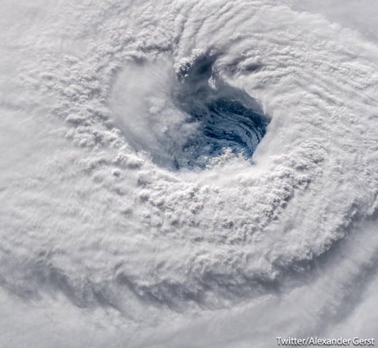
"We could only capture her with a super wide-angle lens." Massive Hurricane #Florence seen from the International Space Station: https://t.co/9jhcrA9Vj7 pic.twitter.com/g2t8hyzZz1
— ABC News (@ABC) September 12, 2018
Water would likely be the main issue out of Florence in West Virginia, Kistner said, not wind.
“There’s so much spread right now between all the forecast model guidance that nobody can hone in on a specific track on where it’s going to go,” he said Wednesday.
The full effects of Florence could start showing themselves in West Virginia anywhere from Sunday to Tuesday, depending on how quickly the storm moves once its ashore.
“There is still potential for a high-end precipitation event, there is still potential as well for flooding and possibly significant flooding across some parts of the state,” said Kistner.
“But, at this time, it’s not possible to actually pinpoint where that will be and it’s not possible to say exactly where the heaviest rainfall is going to fall.”