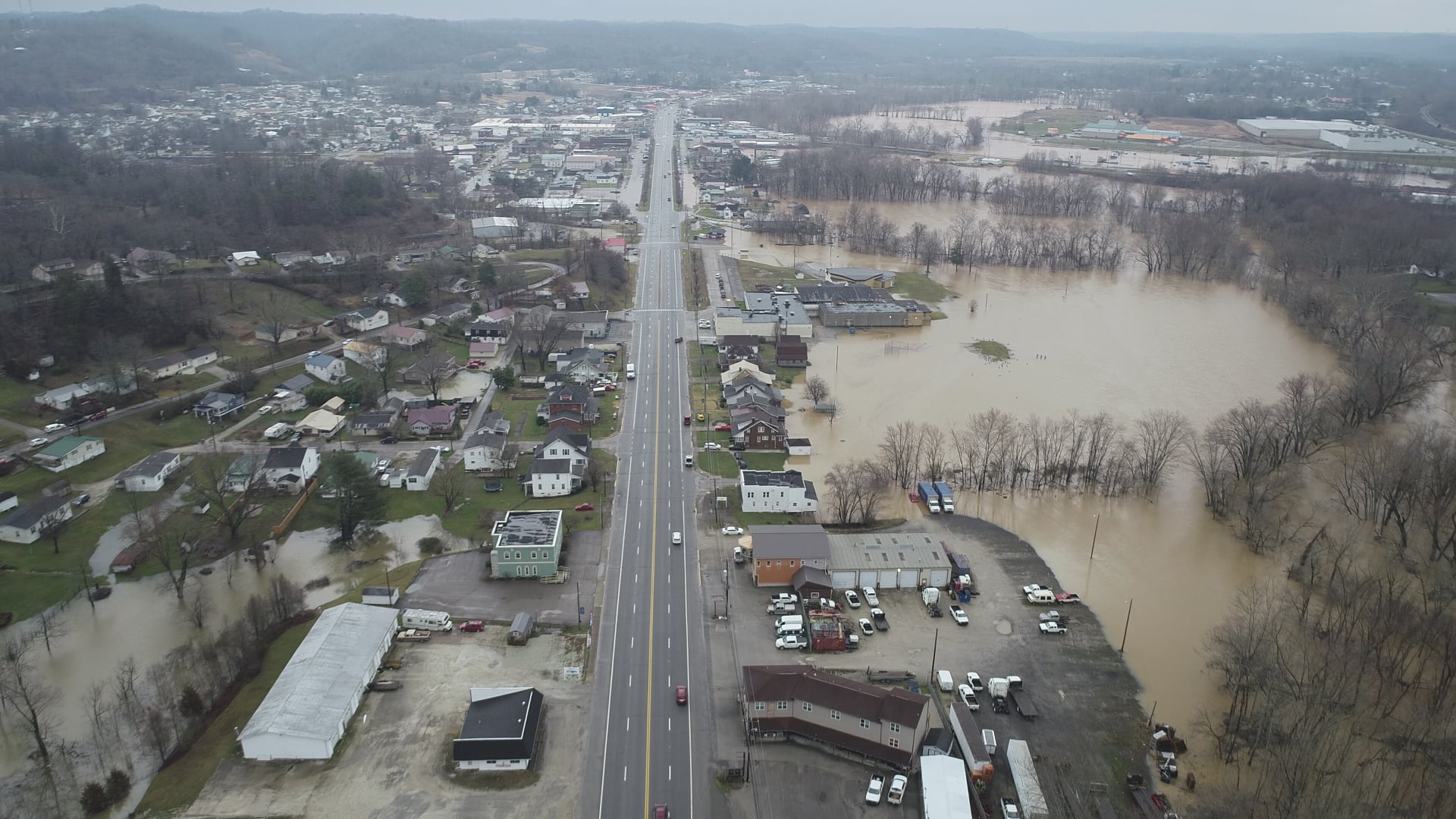


CHARLESTON, W.Va. — The Kanawha River is expected to crest below flood stage Tuesday but that crest will still be the highest for the Kanawha since November 2003.
That’s an indication of the widespread river flooding in West Virginia following heavy weekend rains that began Friday and continued into Monday morning.
Tony Edwards, meteorologist with the National Weather Service’s Charleston Weather Bureau, said the entire state picked up significant rain from Saturday night into Monday morning.
“Anywhere from four to five inches of rain across the southern coalfields up to a little less than 2 inches in the northern part of the state and over in the eastern panhandle,” he explained.
The National Weather did cancel the Elk River flood warning in Kanawha County Monday evening.
The Pocatalico River crested in Sissonville in Kanawha County Monday evening at its highest level since 1998, the Elk River its highest since June 2016.
Highway damage widespread

Reports of rock slides, mudslides, and damaged roadways were widespread across a large area of West Virginia on Monday and the cleanup will take place for several days.
State Deputy Secretary of Transportation Jimmy Wriston said 95 roads remained closed as of Monday evening.
“Our people are the best in the country when it comes to incident management,” Wriston said in a release from the DOH. “They’re always running to the fire. It doesn’t matter what time of day or night you call them, they answer, and they’re on it.”
Check out these District 1 crews cleaning up a mudslide on US Rt. 119 near I-79, Exit 1, in Kanawha County. pic.twitter.com/wOr96toZd1
— WVDOT (@WVDOT) March 1, 2021
Wriston said most of the road closures were in District 1 which includes Boone, Clay, Kanawha, Mason, and Putnam counties, had 58 roads closed on Monday.
DOH Operations Division Director Jake Bumgarner said it was difficult for the agency to properly survey the damage because some larger streams were just beginning to crest Monday evening.
“We will know more in the coming days as we keep assessing the situation and the water starts to recede,” Bumgarner said.
DOH District 1 was reporting several major mudslides. District 10 reported mud and debris on state Route 80 in McDowell County. District 8 reported a detour bridge damaged on Handley Road in Pocahontas County.
Engineers in DOH District 2 were hoping to get a better idea of damage on Tuesday after water recede.
“Now what we’re dealing with is backwater,” District 2 District Manager Scott Eplin said . “The water keeps coming up.”
DOH District 2 includes Cabell, Lincoln, Logan, Mingo, and Wayne counties.
Nitro Fire Chief Casey Mathes and his crew performed several water rescues in the Poca area of Putnam County Monday. He said there were a variety of issues.
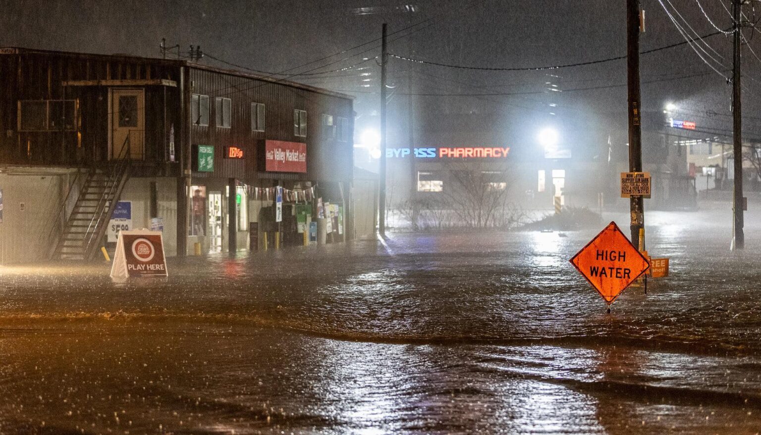
“Some of them, they can’t get out of their house, the water rose so quick. Some people are not being smart by driving through the water,” Mathes said.
He added many residents comment how quickly water from the Poca river rose.
District 3 crews placed high water signs on CR 47/17, River Road in Wood County. pic.twitter.com/tDcq8QNc0m
— WVDOT (@WVDOT) March 1, 2021
In Clay County the Clay-Roane Public Service District reported on their Facebook page the water plant at Procious was broken down due to the flooding. Crews were unsure when they’d be able to access the pumps which were under water.
There were reports of swift water rescues by the National Guard and members of local volunteer fire departments in Boone, Kanawha, Putnam, and Wayne counties from Sunday into early Monday morning.
“Most of it was folks trying to drive through high water,” said C.W. Sigman, Emergency Manager and Fire Coordinator for Kanawha County.
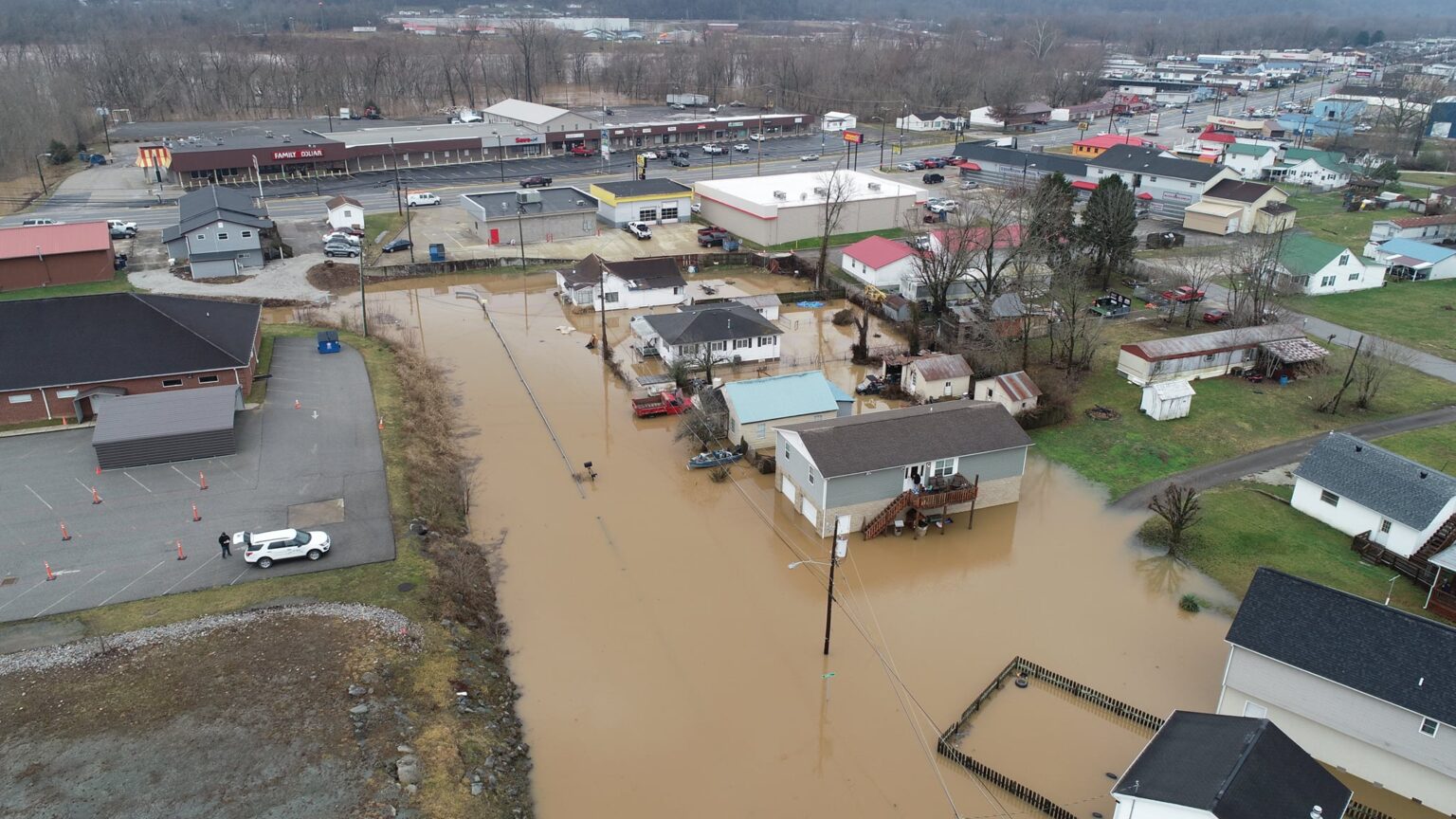
Across social media pictures of mudslides and water around homes and businesses were common.
In Putnam County Emergency Management Director Frank Chapman indicated all of the low-lying areas which normally flood in his county were flooding on Monday. He did it’s unusual for all of them to flood at one time, but blamed much of it on the debris left from the February ice storms.
“A lot of the downed trees, debris, limbs and brush came from that storm and is now causing problems by clogging up culverts and bridge crossings,” Chapman said.
The next phase according to forecasters was the state’s larger rivers which are expected to slowly rise, crest, and then slowly fall as the week goes on.
“That’s going to be a problem for several days, especially on the Ohio River where the backwater flooding can last for several days. It’s going to be with us for several days if not the entire week for some areas,” said Edwards.