CHARLESTON, W.Va. — During a week which has been charged with unsettled weather and the potential for massive rainfall, West Virginia has been able to largely escape without any catastrophic downpours.
The potential for such an event remains for another day and the potential for it to hit the Mountain State increases with each passing hour according to the National Weather Service in Charleston.
“It’s still a little uncertain where the next round will be the most impactful, but the thinking is it will shift more northward. Areas that have escaped it thus far may get more of the action,” said Meteorologist Nick Webb at the Charleston Weather Bureau.
MORE Gov. Justice declares state of emergency in 6 counties, sending 14 Guard members to Kentucky
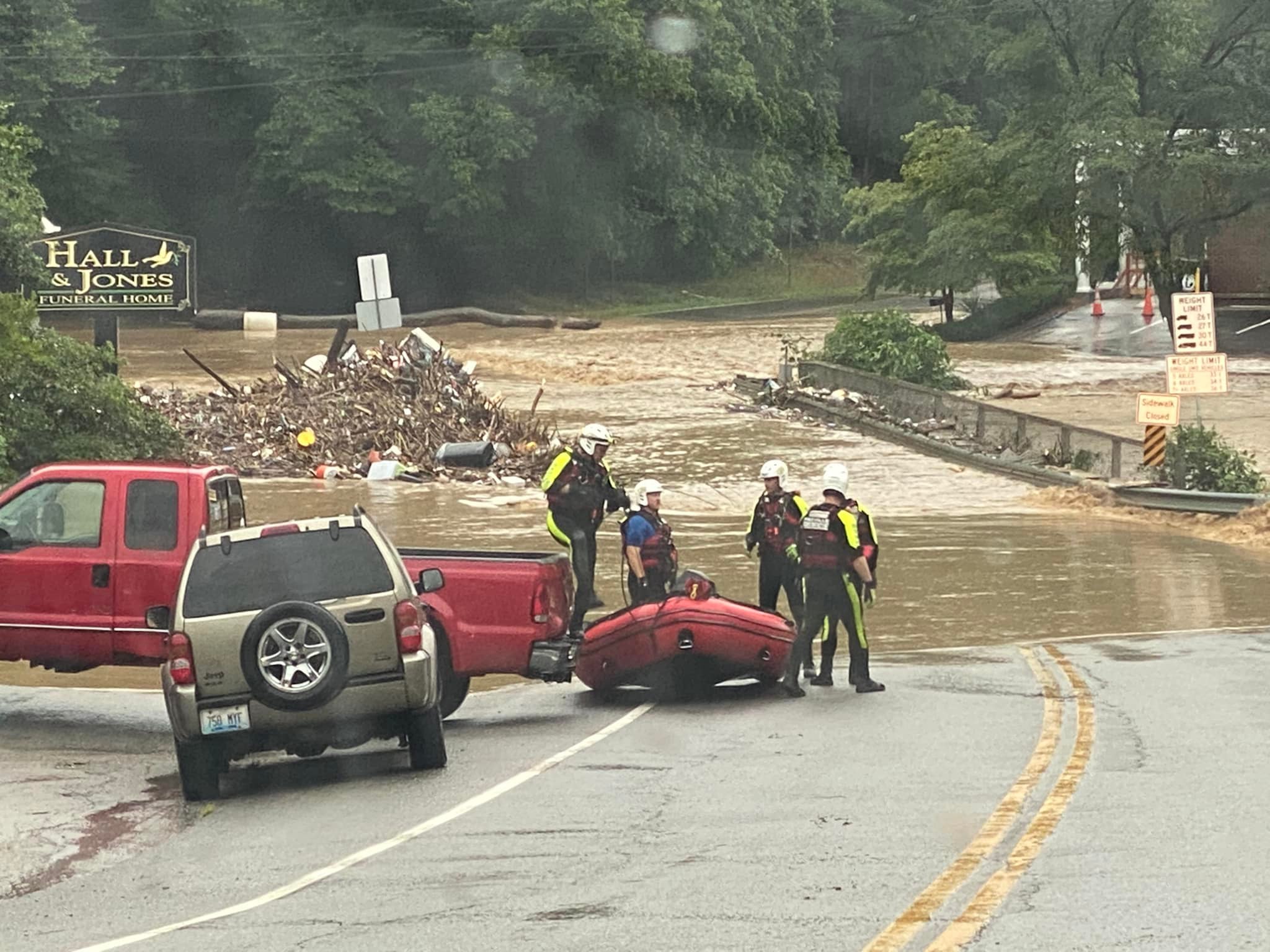
A frontal system has been stationary for several days over West Virginia and has spawned countless downpours. Those so far have not lingered over any particular location in West Virginia for an extended period of time. The phenomena known as “training” is typically what causes catastrophic flooding in the state.
This week there have been a few minor floods which have caused limited damages. A few houses were impacted along Gilbert Creek in Mingo County when it left its banks Tuesday. There have been mudslides and some water covered roadways, but the damage so far has been light.
“We’ve had some trees come down off the mountain, some mudslides, and some water out into the road from stopped up ditches and things like that,” said Teresa Van Dyke, the Emergency Services Director for McDowell County.
Her county is still recovering from the event two weeks ago which damaged homes and businesses in the War and Berwind areas.
“We’ve been on stand-by for the last couple of weeks,” she said.
Neighboring Kentucky is is reeling from massive rain from Wednesday night and Thursday morning. Catastrophic flooding is reported in Pike, Floyd, and other eastern Kentucky counties. Some areas of eastern Kentucky received 6 to 12 inches of rainfall in a 24 hour period.
UNREAL- Let me be clear about what you are seeing – these are entire homes, broken apart and washed away. Total number unknown. Lost Creek, outside of Hazard KY. Coverage now on @foxweather pic.twitter.com/bCZleIdSL0
— Will Nunley (@willnunley) July 28, 2022
Webb worried some of that kind of rainfall was headed toward central parts of West Virginia.
“Central West Virginia, which has escaped most of the heavy rain so far, will probably have a better chance of showers and storms into Friday,” Webb said.
Due to the shift northward of anticipated impact, the NWS has also extended the flood watch. Instead of expiring on Friday morning, it will now end Friday evening.
“We can’t get it down to county level, but just generalized locations in the state. The south of course and more into the central parts of the state into tonight and tomorrow,” Webb added.