

I’ve been forecasting West Virginia weather for 27 years, and there’s one storm folks still bring up at the grocery store, at ballgames, and in my Facebook comments: March 12-14, 1993. You might know it as the Superstorm, the Blizzard of ’93, or simply the Storm of the Century. It earned every one of those names.
It came at a time of year when most of us had seed catalogs on the kitchen table and figured winter was about done. Instead, a storm that formed in the Gulf of Mexico turned into one of the most powerful winter systems the eastern United States has ever seen. When it was over, West Virginia had been buried from the Ohio River to the Allegheny Front.
A storm that grew up fast
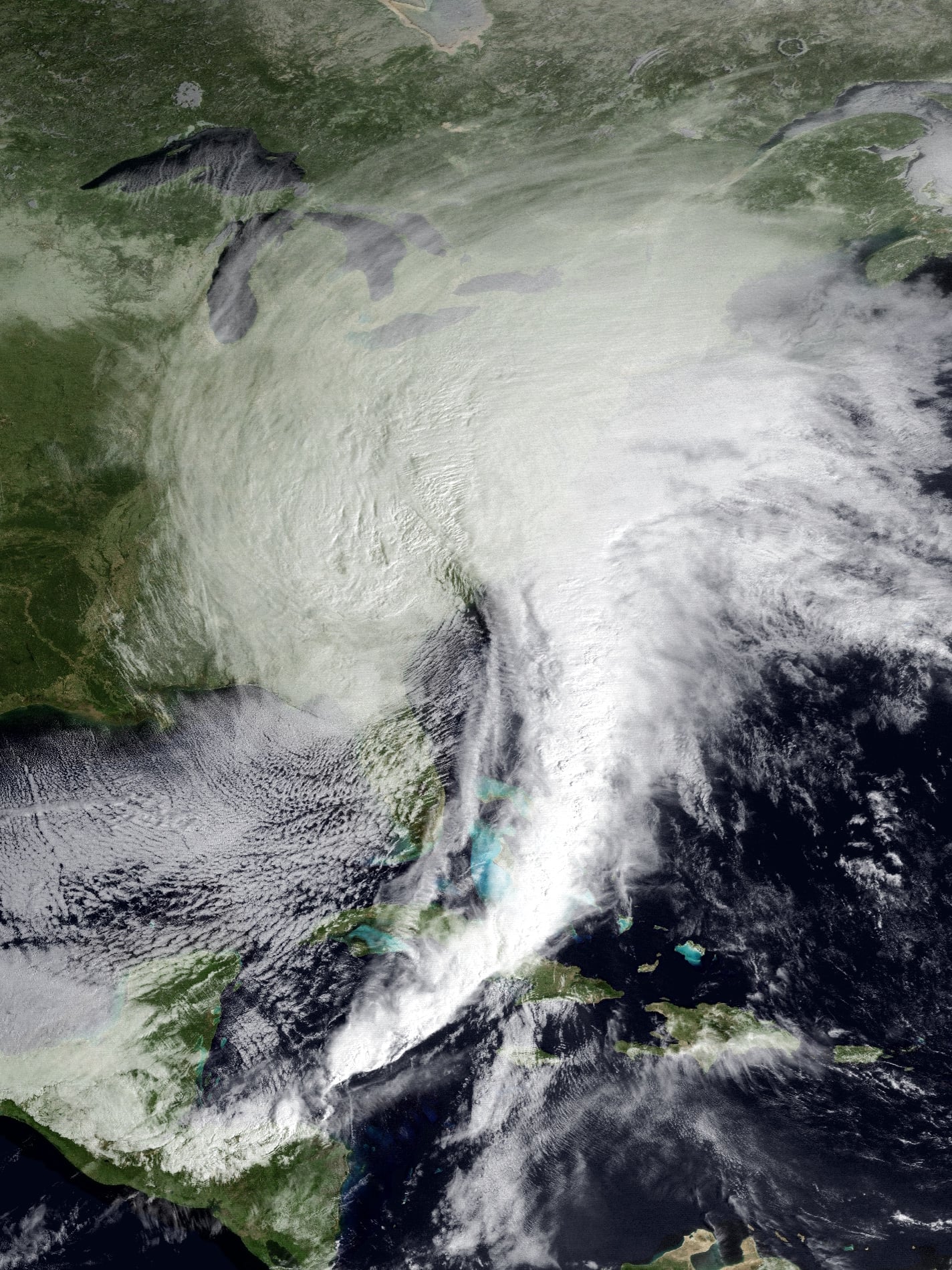
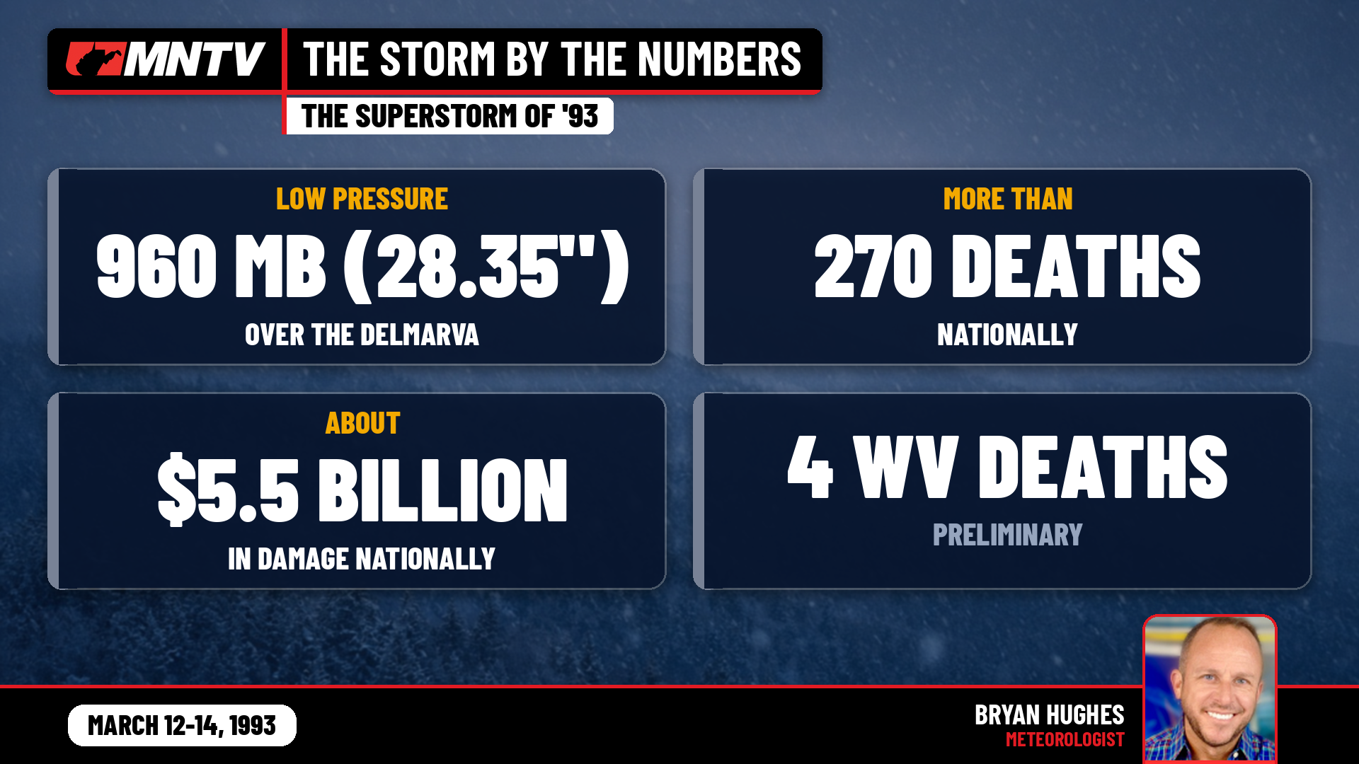
On March 12, the low-pressure center took shape over the western Gulf. With cold air from the north and warm, wet Gulf air from the south, it exploded as it raced up the East Coast. By the evening of March 13 its central pressure had dropped to 960 millibars, about 28.35 inches of mercury, over the Delmarva Peninsula. That’s the kind of reading we usually associate with a strong hurricane, not a snowstorm.
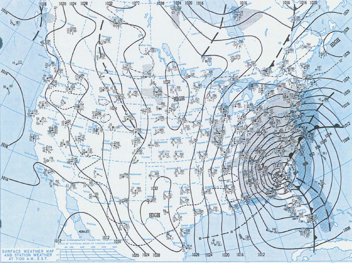
Here in the mountains we were on the cold side of that monster, and that’s where the heavy snow falls. The National Weather Service in Charleston describes many lowland areas getting 1 to 2 feet and the West Virginia mountains 2 to 3 feet, with strong north-to-northeast winds whipping it into blizzard conditions and whiteouts.
How much snow fell
These are the official totals from the National Weather Service’s records for March 12-14, 1993:
– Beckley: 30.9 inches
– Huntington: 22.6 inches
– Parkersburg: 20.3 inches
– Charleston: 19.4 inches
– Elkins: 18.9 inches
– Clarksburg: 18.0 inches
– Snowshoe (official co-op gauge): about 31.5 to 34.5 inches, depending on which daily reports you count
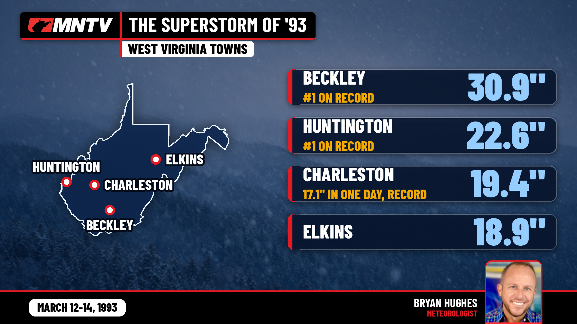
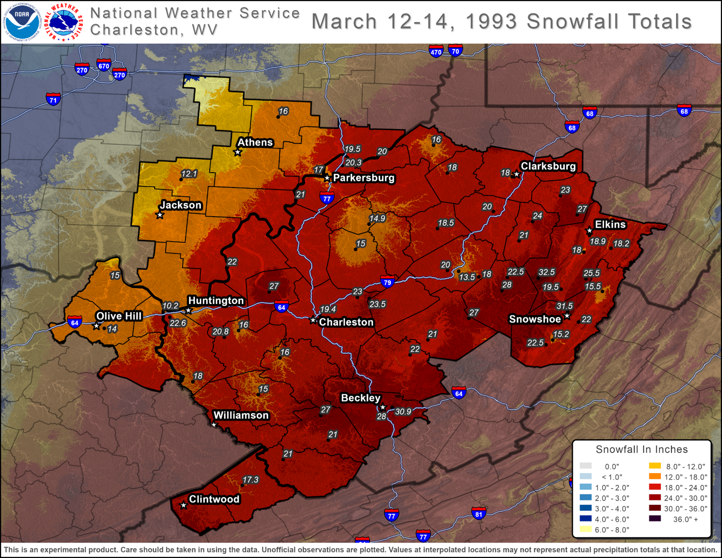
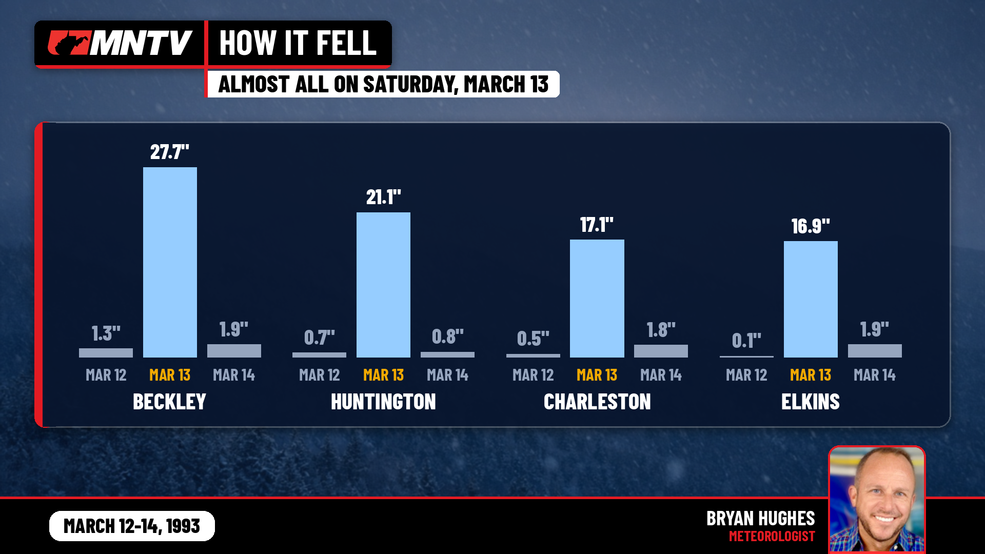
Most of that came down in a single day. March 13, 1993, is still the snowiest day ever recorded in Charleston: 17.1 inches in 24 hours, the city’s all-time record. Huntington picked up 21.1 inches that day and Parkersburg 20.1, both daily records for those sites too.
Beckley took the worst of it. Beckley got 27.7 inches on March 13 alone, and the 30.9-inch storm total is still Beckley’s biggest snowstorm on record. Think about that for a second. Beckley has seen plenty of big storms in the years since, and none has topped 1993.
Then there’s Snowshoe. You’ll often see 44 inches quoted for Snowshoe in national storm summaries, including NOAA’s own. But the official weather observer at Snowshoe, at 4,802 feet, logged 26 inches on a single day of the storm, and the daily reports add up to roughly 31.5 to 34.5 inches. That’s still close to 3 feet of snow, but I’m going with the gauge.
The forecast that changed forecasting
What makes this storm special to a meteorologist like me isn’t just the snow. It’s that we saw it coming.
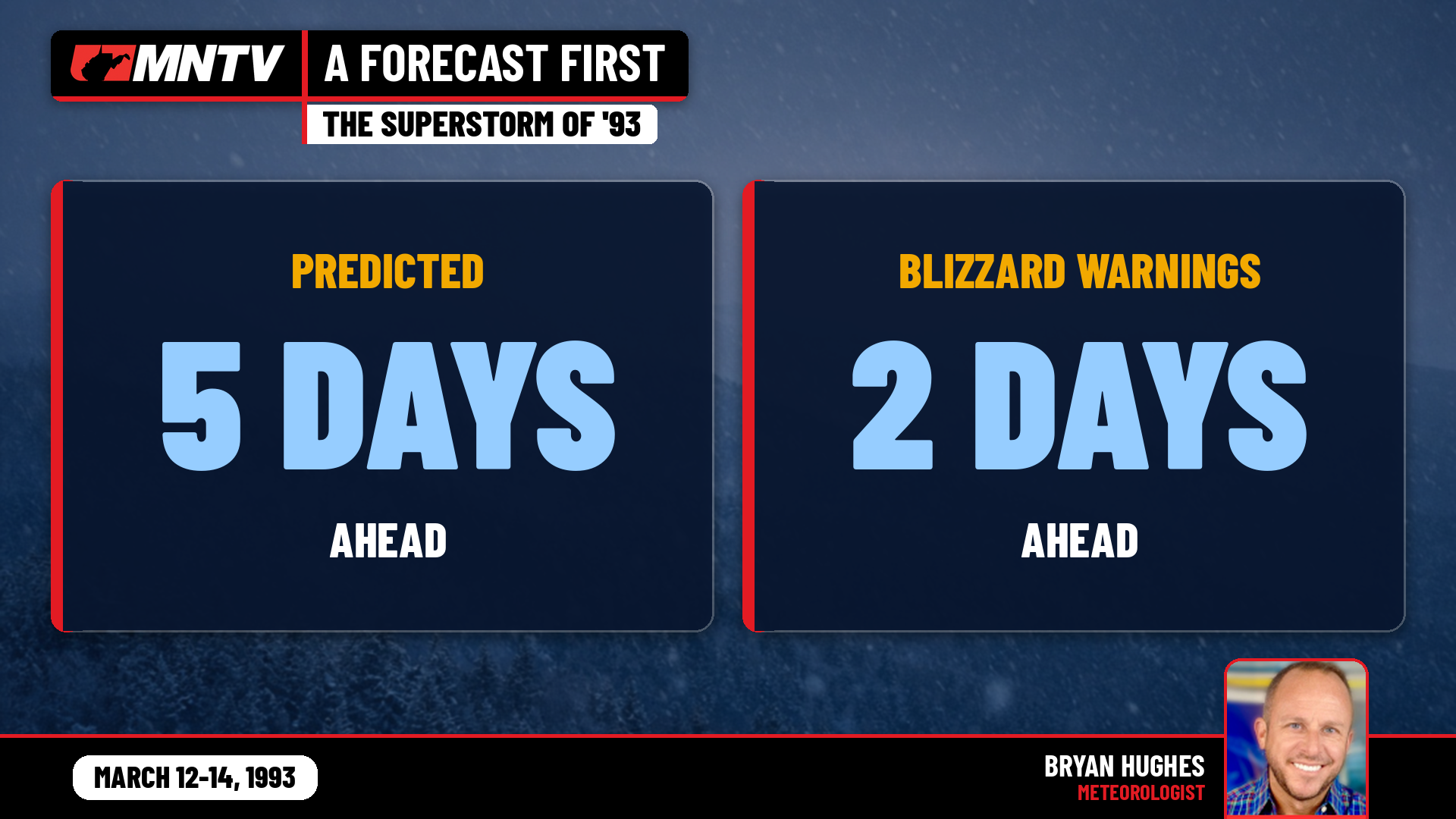
For the first time, National Weather Service forecasters predicted a storm of this size five days ahead and issued blizzard warnings two days in advance. Forecasters saw the storm forming five days out, called its unusual strength three days out, and had the heavy-snow forecast pinned down two days out. Back in 1993 that was unheard of. It gave families, road crews, utilities and emergency managers time to get ready, and there’s no doubt it saved lives.
The cold that followed
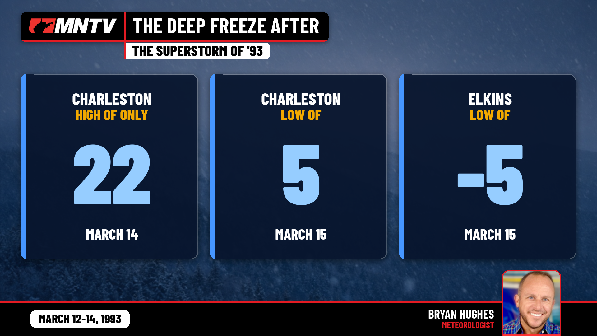
When the snow stopped, the arctic air settled in. Elkins dropped to 5 degrees below zero on March 15, one of the record lows set across the East in the storm’s wake. Charleston’s low that morning was 5 degrees. Fresh, deep snow cover under clear skies is a recipe for brutal cold, and mid-March in 1993 felt more like mid-January.
The toll
NOAA’s preliminary count listed four storm-related deaths in West Virginia. Across the country, more than 270 people in 13 states died, with damage of around $5.5 billion at the time. The storm affected roughly 120 million people.
Across the storm’s path, the National Guard was called out, states of emergency and curfews were declared, interstates from Atlanta northward were generally closed, and every major airport on the East Coast shut down at some point. The weight of heavy, wet, wind-drifted snow caused hundreds of roof collapses, and more than 3 million customers lost power at one time or another.
Where were you in ’93?
Thirty-three years later, the Superstorm is still the measuring stick. Every time I put a big number on a forecast map, someone asks, “Is it going to be like ’93?” So far the answer for most of us has been no.
Now I want to hear from you. Where were you when the Storm of the Century hit? Were you snowed in for days, shoveling a roof, digging out a car you couldn’t find, or sledding down a street that hadn’t seen a plow? Share your memories and photos in the comments. Whether you were in St. Albans, Beckley or up in the mountains, I’d love to hear your Blizzard of ’93 story.