

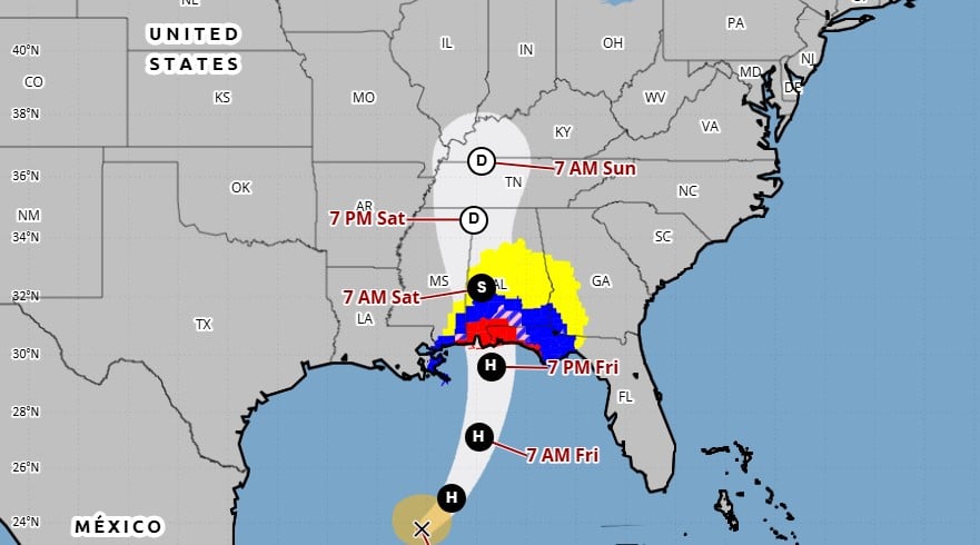
CHARLESTON, W.Va. — The brilliant sunshine and mild temperatures in West Virginia will come to an end on Sunday. The National Weather Service says the remnants of Hurricane Isaias should arrive Sunday in the lower Ohio River valley and will spinoff rainfall throughout the day and into the start of the new week. However, it will be welcome rainfall for the Mountain State.
“Pretty strong lift associated with that will be squeezing out some precipitation. We’ve been pretty dry for several days so it’s getting pretty crispy out there actually. So, this rain will be a relief for most,” said NWS Meteorologist John Peck.
Although the chance of a training showers in the storm system can’t be ruled out, Peck said he doubted the system would be damaging or create flooding. He said overall, it’s a welcome relief.
“We can take quite a bit of water, most of this will be welcomed. You could have some potentially high water, but that will mostly be in southeast Ohio, that could potentially yield some very isolated high water issues, but this will be primarily a beneficial rain,” he said.
The system coming from the hurricane in the Gulf will meet up with a cold front moving in from the northwest which will add additional moisture and lower temperatures.