

UPDATE: 1:30 p.m. The first tornado warning of the day issued for Calhoun, Ritchie and Gilmer counties until 2 p.m. The tornado was radar indicated.
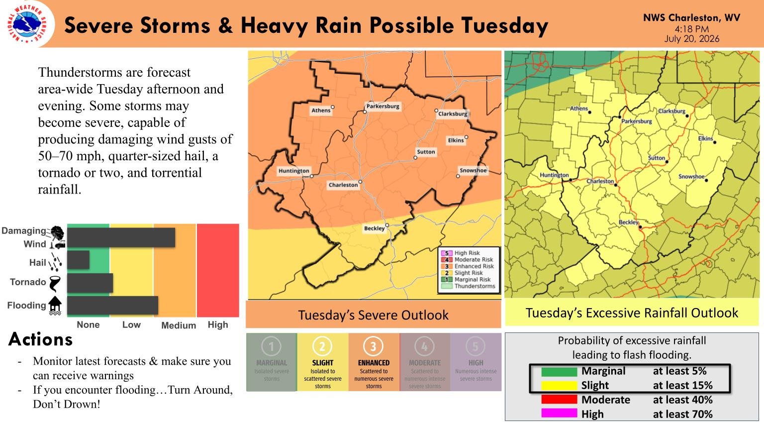
CHARLESTON, W.Va. — West Virginians are under an Enhanced Risk for severe weather today as a potent summer storm system sweeps through the Ohio Valley and into the Mid-Atlantic.
The Storm Prediction Center warns that while all severe hazards are possible, the primary threat this afternoon and evening will be swaths of damaging wind gusts.
According to the National Weather Service in Charleston, a decaying morning convective system will give way to a rapidly destabilizing atmosphere, generating widespread showers and thunderstorms area-wide.
While the main risk remains severe straight-line winds, forecasters note the potential for large hail and an isolated, line-embedded tornado. Torrential downpours will accompany the strongest storms, bringing a risk for highly localized flash flooding in areas that experience repeated rounds of heavy rain.
Short-range HRRR guidance suggests the main convective activity will press into Huntington and the Ohio River Valley by early to mid-afternoon, capitalizing on localized river valley warming. As the line pushes east toward the Kanawha Valley by late afternoon, the system’s dynamic forcing is expected to easily overpower any typical cold-air pooling near Charleston. By evening, the severe threat will traverse the higher elevations near Beckley and across the northern counties, where Parkersburg and Clarksburg will see sharp temperature drops and periods of blinding rain behind the cold front.