

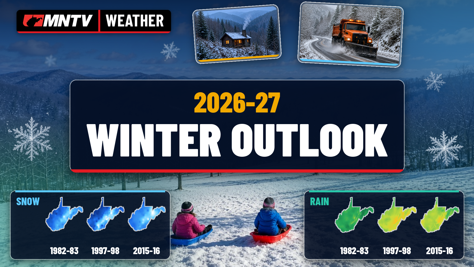
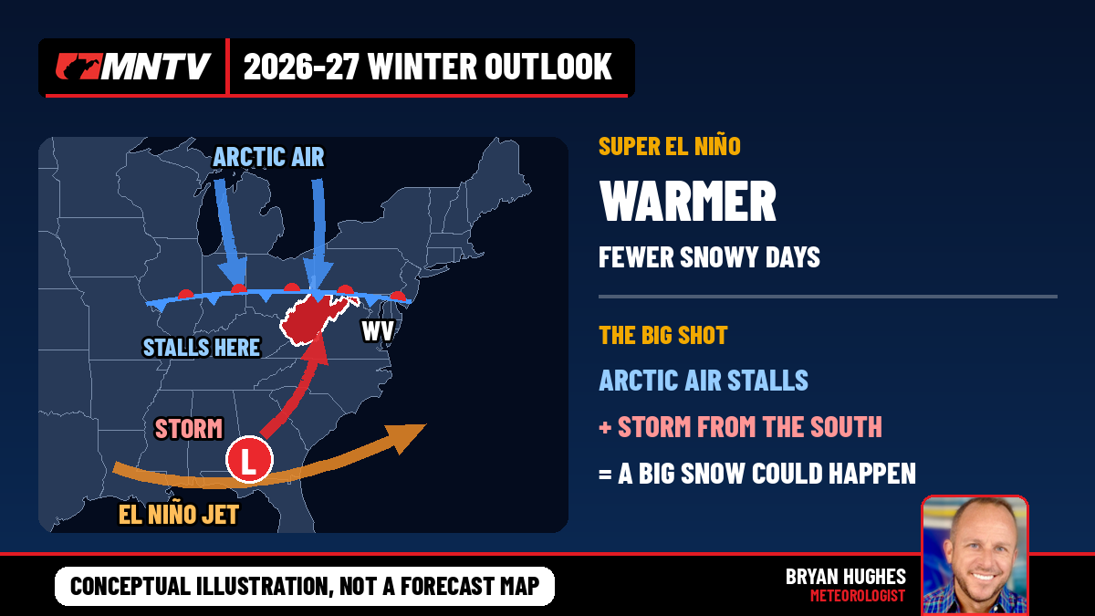
Here’s the bottom line: this winter is leaning warmer than normal across West Virginia, with fewer cold, snowy days in between. But one or two big storms could still bring a lot of snow. That’s the signal from NOAA, from many of the scientists who study El Niño, and from our own history. But history is just as clear on one other point. Even our mildest El Niño winters have produced some of the biggest storms in state history, and they usually came late.
How strong is this El Niño?
Very strong, and still strengthening.
The Climate Prediction Center has an El Niño Advisory in effect. In its October 8 update, CPC said El Niño “continues to strengthen” and that a strong-to-very strong event is likely through January-March. Forecasters put the chance at 83% that this becomes the strongest El Niño since at least 1950 during October through December.
Columbia University’s International Research Institute reported on October 19 that the weekly Niño-3.4 ocean temperature reached 3.3°C above normal.
What NOAA’s winter outlook says for West Virginia
NOAA’s official December-February outlook came out October 15. For temperatures, all of West Virginia sits in the 40-50% chance of above-normal range. That’s a clear lean toward a mild winter, though not a guarantee.
For precipitation, most of the state, including Charleston, Beckley, Elkins and Morgantown, has a 33-40% chance of above normal. The Eastern Panhandle is a little higher at 40-50%. Far western West Virginia, around Huntington, is in “equal chances,” right on the edge of the Ohio Valley, where NOAA isn’t leaning either way.
NOAA is also clear that its seasonal outlook doesn’t forecast snowfall. Snow, the agency notes, generally can’t be predicted more than about a week ahead.
What other scientists are saying
The outlook has broad agreement behind it.
National Weather Service director Ken Graham said a very strong El Niño “will likely bring a southward and eastward shift to the jet stream,” tilting the odds toward stormier weather in the South.
National outlets expect less snow than average for much of the Northeast and Midwest, with the southern Appalachians having a better chance of finishing near or above average. As one national long-range forecaster put it, “it only takes one storm to flip the script,” pointing to late January and February as the time to watch.
Next door in Ohio, state climatologist Aaron Wilson of Ohio State said, “I expect temperatures to fluctuate considerably this winter with a few bouts of cold air but fewer sustained cold periods.” He described his confidence as medium.
Why El Niño matters here
The science is well established. The Climate Prediction Center explains that during El Niño the Pacific jet stream extends east and shifts south. That shifts the storm track from the northern U.S. toward the southern U.S. It also cuts back on the cold air flowing down from Canada.
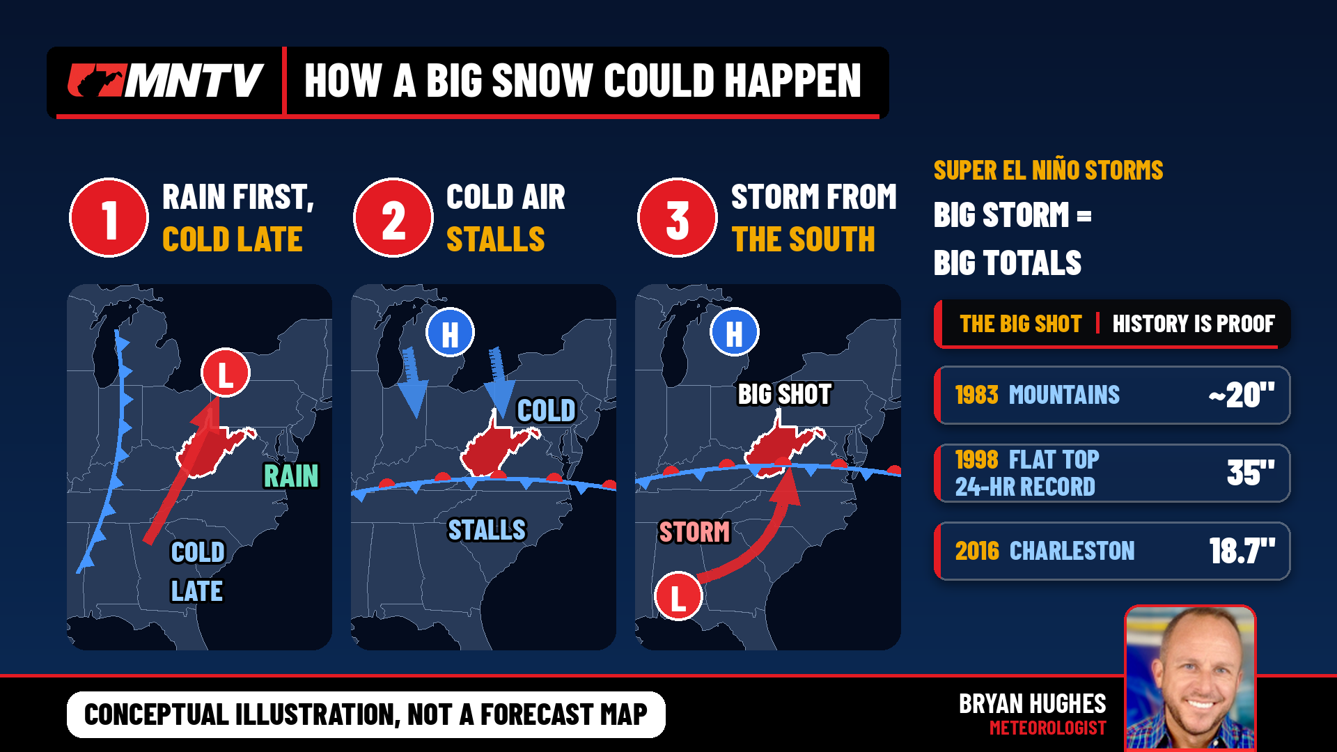
For us, that means more storms coming out of the Gulf and the Southeast. When one of those lows turns up the East Coast with just enough cold air in place, the mountains can get buried. When the cold air isn’t there, it’s rain. Usually there’s a lot of it.
What history shows
Our own records from those three super El Niño winters tell the story.
1982-83: Dry, mild, then one big storm. December through February was 2 to 6 inches drier than normal at every major airport, according to NOAA station data. The National Weather Service in Charleston described that winter as “unusually warm and stormy,” with most storms bringing rain. Then came the February 10-12 nor’easter. It brought 6 inches along the Ohio River and nearly 20 inches in the mountains, with most of the state averaging about 10 inches. The NWS ranks it as the number one nor’easter to affect West Virginia, based on how much of the state saw 10 inches or more. Canaan Valley’s co-op observer recorded 35 inches of snow for the month of February.
1997-98: The elevation storm. On January 27-28, a coastal low brought rain to Charleston while the mountains just to the southeast got buried. Flat Top picked up 35 inches in 24 hours, the state record listed by the NWS. Beckley’s airport recorded 25.5 inches over the two days, and January 27 alone ranks as one of the city’s snowiest days on record. NOAA’s Storm Data reported up to 3 feet of “very wet, heavy snow” in spots, and a Beckley supermarket roof collapsed under the weight. Beckley finished January with 29.2 inches.
2015-16: A green December, then a blizzard. December was warm and wet, and Charleston saw less than half an inch of snow. Then the January 21-23 storm dropped 18.7 inches at Charleston’s Yeager Airport, including 15.0 inches on January 22 alone.
Mountains versus lowlands
Those winters didn’t treat every part of the state the same.
Elkins finished below its normal snowfall in all three winters. In 1997-98 it was about 24 inches short. Beckley swung from nearly 30 inches above normal in 1997-98 to 8 inches below in 2015-16. Huntington, down in the Ohio Valley, came in above normal in two of the three.
More rain didn’t always mean more snow, either. In 1982-83, every station was dry, yet the snow totals still came in close to normal, thanks mostly to one February storm.
What it means for this winter
My best read: warmer than normal overall, with fewer cold, snowy days in between. A cold, snowy winter from start to finish looks unlikely. But one or two big storms could still bring a lot of snow.
But I wouldn’t write off winter if December turns out green. In all three of the past super El Niño winters, West Virginia’s biggest snow came in late January or February. The storm track this pattern favors is the same one that delivered those storms.
We’ll keep a close eye on it and keep you posted as each storm gets closer.
Sources: NOAA Climate Prediction Center; NOAA National Weather Service, Charleston; NOAA Regional Climate Centers (ACIS); NOAA Storm Data; Columbia University IRI; national outlets; The Ohio State University.